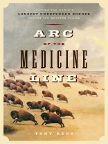
The border between Canada and the United States- the longest undefended border in the world-was laid out in many stages over more than a century, but the biggest part of the job was the long, (mostly) straight line across the prairies. On September 18, 1872, a full five years after confederation, two large teams of army surveyors-one from each country-met at the Red River on the Manitoba-Minnesota border. They were there to fix, for the first time, the precise location of the 49th Parallel between the swampy shores of the Lake of the Woods-where the border had an awkward, keyhole-shaped notch that was the source of much tension-and the summit of the continental divide in the Rockies. Over the next two years, the members of the International Boundary Commission went about the business of surveying, mapping and placing markers across nearly 900 miles of unforgiving territory. Through the work of its brilliant naturalists, the Commission created the first accurate descriptions of what was still largely terra incognita. In drawing the Medicine Line across the High Plains, the Boundary Commission defined the final shape of a new nation and ended, once and for all, the old American dream of Manifest Destiny.
Langue Anglais ● Format PDF ● Pages 384 ● ISBN 9781553659891 ● Taille du fichier 20.9 MB ● Maison d’édition Douglas and McIntyre (2013) Ltd. ● Publié 2012 ● Téléchargeable 24 mois ● Devise EUR ● ID 5275377 ● Protection contre la copie Adobe DRM
Nécessite un lecteur de livre électronique compatible DRM


